Thomas Jefferson Planning District
The Thomas Jefferson Planning District is a dynamic region in Central Virginia known for its rich history, vibrant community, and natural beauty. The district includes Greene, Albemarle, Louisa, Nelson, and Fluvanna counties and the City of Charlottesville. Located in the foothills of the Blue Ridge Mountains and home to the University of Virginia and Monticello, the area has a deep tradition of civic engagement and environmental stewardship. Today, it is home to many dedicated organizations who are actively caring for parks, waterways, greenspaces, and neighborhoods. From tree planting initiatives and stream cleanups to community gardens and environmental education, stewardship is thriving across the region.
STEW-MAPs offer the ability to celebrate, connect, and strengthen networks of environmental stewards such as this one. The Thomas Jefferson Planning District Commission (TJPDC) developed a regional STEW-MAP to visualize who is doing stewardship work, where it is happening, and how different groups are connected. With so much activity happening in the district, the project aimed to identify potential gaps in stewardship work, promote greater collaboration between groups, connect volunteers with organizations in their area, and better inform the distribution of resources across the region.
From April to September 2023, the TJPDC distributed a survey to groups known to be focused on land and water stewardship in the region. Additional organizations identified through connections in the initial survey were also invited to participate. The survey gathered data on groups’ stewardship types, site types, focus, funding sources, where they seek information, who they identify as key collaborators, and their turf (geographic area in which they carry out their environmental stewardship work).
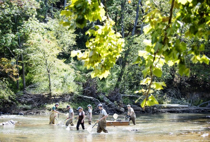
The Rivanna Conservation Alliance is a nonprofit organization in the district working to steward the Rivanna River watershed through a range of activities, including fish surveys as pictured here. (Photo by Ashley Twiggs)
The STEW-MAP survey identified 46 groups working in the region, including nonprofit organizations, university-affiliated groups, and state and local governments. An aggregated network map shows 548 total connections between these organizations. In addition to a map of each group’s overlapping turf with specific information about each organization, a series of network maps are also publicly available. These include maps of funding networks, key collaborators, and knowledge networks between each group.
The TJPDC plans to reopen the survey and update the STEW-MAP every few years to reflect new partnerships, additional stewardship groups, and changes happening within organizations. With more resources now available such as a video tutorial for navigating the dashboard, we hope to increase access to the STEW-MAP TJPDC and widen its impacts in our community.
STEW-MAP TJPDC Resources:
Video Tutorial: Navigating the STEWMAP TJPDC Dashboard and Network Maps
Contacts:
Isabella O’Brien
TJPDC Regional Environmental Planner, Project Coordinator to STEW-MAP TJPDC
Ruth Emerick
TJPDC Chief Operating Officer and Program Director, Data Analyst and GIS Technician to STEW-MAP TJPDC
Logan Ende
TJPDC Planner 2, Data Analyst and GIS Technician to STEW-MAP TJPDC

